The Shabelle Basin Diagnostic and Strategic Action Plan (SAP) was published in January 2022. The SAP includes the preparation of a flood prevention plan. Key input for this plan is a detailed bare-ground and hydrologically correct Digital Elevation Model (DEM) of the riparian zone. The DEM will be used to identify and analyze: 1) flood prone areas, 2) area that can be used for (temporary) water storage and groundwater recharge, and 3) existing infrastructure such as embankments and roads that may affect inundation patterns. Evidently, the DEM is also used for many other functions.
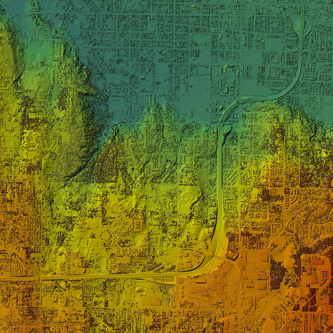
Because of the very low relief and inverse topography of large parts of the riparian zone—where the river is above the surrounding land—the DEM must represent the terrain features with high horizontal and vertical precision. This calls for a LiDAR scan.
Airborne LiDAR has high accuracy, high point density, can cover large areas, and should be relatively cost effective. I set out to prepare a Terms of Reference. This was more complicated than anticipated. It may therefore be useful to share my ‘lessons learned’. They are presented in the remainder of this post. Note that this text is written for water resources managers and hydrographers—not for remote sensing experts with lots of LiDAR experience.
Carefully delineate the study area to minimize the aerial extent of the LiDAR scan
Airborne LiDAR is cost effective but not for free. The standard rate in the USA for an airborne LiDAR scan is around 125 US$ per square kilometer (exclusive data processing and establishing Ground Control Points). This is probably substantially higher in most of Africa for logistic reasons.
Further, a flight day (~4 hours airborne) can capture LiDAR data for approximately 150-200 km2. In most projects, orthophoto’s are being captured simultaneously during the day. While the LiDAR sensor also works at night, orthophoto’s require day light. Casually expanding the study area, therefore, will increase flight days and the duration of the project. It will also increase the number of ground control points that are required. Further, each square kilometer will generate about 60-100 mb of data, and data management for a large study area may soon become overwhelming.
Thus, a first step in designing a project is to very carefully delineate the study area to minimize it to the extent possible. Areas that do not require high-precision terrain data should not be included just for the sake of a contiguous coverage (unless you have a very large budget).
The quality of the data product is a function of the ground control points
It is easy to define data quality specifications. These typically stipulate that 95% of the bare-earth points meet or exceed the specified accuracy level (1 x 1 m2 resolution; 10 cm vertical precision and 20 cm horizontal precision; vertical RMSE not more than 5 cm and horizontal RMSE not more than 10 cm).
But how to ensure that these specifications are met?
For this, the contractor uses ground control points and conspicuous terrain features. In some countries, an archive of ground control points is maintained that can be used to geo-reference the LiDAR image. Further, comparing the intersection between adjacent roof planes in overlapping LiDAR strips provides an additional quality check in urban and peri-urban areas. However, these quality control options may not be available—in adequate numbers—in remote rural areas, or in countries that do not maintain a geodetic archive. Here, a large set of new ground control points must be established.
The bottom line is that an adequate set of control features—either roof plane intersections or ground control points—is a prerequisite for data quality. Keep this in mind when designing the project.
Ground control points and security and accessibility considerations
As discussed above, quite some new ground control points may be needed in remote rural areas to ensure that quality specifications are met. It raises questions about accessibility and security for the survey teams. We cannot just point to a map and say we need a point in this and that location. It is more complicated.
Thus, developing the flight plan needs to consider the (potential) difficulties in obtaining ground control points. Best is when the flight plan and survey plan are developed together. This exercise should review the established control points and terrain features that can be used for quality control, determine the need for extra ground control points, and consider how easy or difficult it is to survey these points.
Do not underestimate the field survey. It can be a major challenge—and a key constraint in getting a high-quality LiDAR-based data product.

“Bite what you can chew”: a phased implementation plan
For large areas that involve many flight days and lots of ground control points that must be surveyed prior to the scan, consider developing a phased implementation plan to break the project into manageable blocks. This is specifically relevant when the field survey is difficult because of the remoteness of the terrain, security concerns, or administrative challenges to get the required permits. Note that ground control points must be measured in the same season as the LiDAR scan to get the required data accuracy. As a rule of thumb, consider breaking the project into blocks of 20 flying days.
Do not forget data management
A LiDAR scan produces a massive volume of data—some 60-100 mb per km2. Thus, an area of 100 km2 will generate 6-10 GB of data; that is a lot.
Note that data management is not free. A provision must be made in the project budget for the costs associated with data management; best is to budget for at least 5 years. In addition, a decision is needed on how to store these data—server, desktop, or cloud—and if and how to make it available to the wider public. If you opt for a tiles system in the cloud with selected access, a dedicated website must be designed, developed, and maintained, which will all cost money.
Post processing is the easy bit
Once the LiDAR data are captured, post-processing is relatively easy and can be implemented by the contractor at their office. A lot of data processing is automated. This is the easy bit.

An airborne LiDAR scan is not a lumpsum project
By now it should be clear that a LiDAR scan of a large and remote area is a complicated endeavor that must be carefully designed. This is not a lumpsum project that consists of predefined elements with fixed costs. Instead, there are many uncertainties when preparing the budget:
- Is there a system of existing ground control points (maintained by the national geodetic agency)?
- How many new ground-control-points are needed?
- How difficult is it to survey these points? Can we recruit local surveyors?
- How much time will it take to complete the ground survey?
- What is the size of the area we can cover in a single season (ground control survey and airborne LiDAR scan)?
- Where does the aircraft come from? Where does the equipment come from?
- How much time (and money) does it take to get the required permits for the LiDAR scan?
- How do we store and manage the data?
Thus, the final cost estimate for such a tailor-made project will probably be determined through a continuous (and iterative) discussion between the client and the contractor.
Final thought: a project of this level of complexity will benefit from a dedicated (and experienced) project manager.
Closing remarks: a LiDAR scan of a large rural area is complicated
A “one-size fits all approach” does not work for a Terms of Reference (ToR) for a LiDAR scan for a large, rural, and remote area where the network of existing ground control points is inadequate or not available. The client should recognize that this is a complicated project. Thus, the ToR must be prepared by a person with very good knowledge of the local geodetic system and existing terrain features, or the project is best designed jointly by the client and contractor—in an iterative process.
It is understood that a field survey is expensive and time consuming. Nevertheless, ground control points are essential to ensure the quality of the data product. Remember: water always flows downhill (even if a DEM that was developed with inadequate ground control points indicates that it flows in the opposite direction….).
REFERENCES
Lidar 101: An Introduction to Lidar Technology, Data, and Applications; National Oceanic and Atmospheric Administration (NOAA), 2012
Many thanks to Richard Shacklock @ Geosense for his insights when preparing this post.