A detailed water resources analysis is data intensive. Take for instance the response to a rain event. Whether a raindrop will runoff, infiltrate, or evaporate will depend on a large group of parameters that include rainfall regime, temperature, soil type, vegetation type, land use, relief, geology, etc. All the above parameters are subject to high spatial variability. Ideally, all should be measured at adequate scale.
Water agencies, however, are invariably constrained in terms of budgetary resources. In a watershed stretching over thousands of square kilometers, they typically operate just a handful of hydromet stations. It is just the way it is.
The above implies that almost every water resources assessment relies on a substantial level of generalization and approximation. Sometimes this is acceptable. Nevertheless, it inevitably introduces a level of uncertainty and reduces the quality of the information on which water management and investment decisions are based.
Is there a role for citizen scientists to alleviate the scarcity of water data?
ISO certification concerns
Citizen science aims to mobilize the general public to collect scientific data. Many citizen scientists are motivated by curiosity or because they wish to contribute to environmental protection. Other parties that collect weather and environmental data are schools—for educational purpose—and commercial farms—to improve irrigation and farming practices. Mining operations and power companies also collect environmental data.
Private data collection initiatives have expanded in recent years because 1) electronic sensors and dataloggers have become affordable, and 2) internet access is widespread and makes it easy to exchange data. These trends will only accelerate.
Some water agencies ignore these ‘free’ data. Others acknowledge their value but are reluctant to collect and disseminate these data because of ISO certification concerns. I understand the latter.
What I find difficult to understand is that water agencies do not make a bigger effort to use these data—while at the same time encourage and assist citizen scientists and other private parties to expand their data collection efforts and publish these data on the internet. After all, these data are for free. They will only increase our understanding of the hydrological processes.
Data Quality
A common criticism of data collected by citizen scientists and other parties is that they do not meet quality standards. So, let’s have a closer look at data quality.
There are many definitions of data quality. Data should, obviously, correctly represent the natural or hydrological phenomena to which they refer. But, at what level of precision? Or, at what spatial resolution?
According to Wikipedia, data quality is a function of many factors that include accuracy, completeness, consistency, credibility, timeliness, validity, and others.
The ISO criteria exclusively focus on accuracy. One can argue that other important factors—such as coverage and timeliness—are not adequately weighted in the discussion whether to exclude the water data collected by citizen scientists.
In practice, data quality requirements in water resources management are a function of the data application. Do they help us to gain a better understanding of the dynamics of a specific water resources issue?
If the answer is yes, the data are useful. Even if they do not meet the highest ISO standards.
The case of Weather Underground
A useful example is Weather Underground. While this is a commercial operation, it collects and shares data from more than 250,000 personal weather stations—abbreviated to PWS—around the world. Most of these PWS are quite simple and quite cheap. For instance, I have operated an Ambient Weather Station costing some 250 US$ for about 5 years now—just out of curiosity. It is easy to install and easy to connect to the internet. Weather Underground provides the infrastructure—in this case the cloud-based software—for data exchange, data archiving, and data visualizing.
Hence Weather Underground takes care of all costs associated with keeping the IT infrastructure running (such as server maintenance, anti-virus, data backup, database maintenance, software upgrades, etc.), while individuals pay for the weather stations. What is there not to like about this?
It is acknowledged that most PWS do not produce high grade data that meet ISO standards. Yet the PWS data represent information.
Regarding water data, I think an analogy of the Law of Large Numbers applies. This law states that “the average of the results obtained from a large number of trials should be close to the expected value”. For hydromet data this can be paraphrased as “the more data points used for surface or curve fitting, the likelier it is that the hydromet event is correctly described”.
Hence encouraging individuals—or schools and farms—in data scarce regions to operate a PWS will substantially increase our understanding of the hydrological phenomena, specifically if these data are combined with other data sources such as satellite images or a weather radar.
Other Potential Citizen Science Initiatives
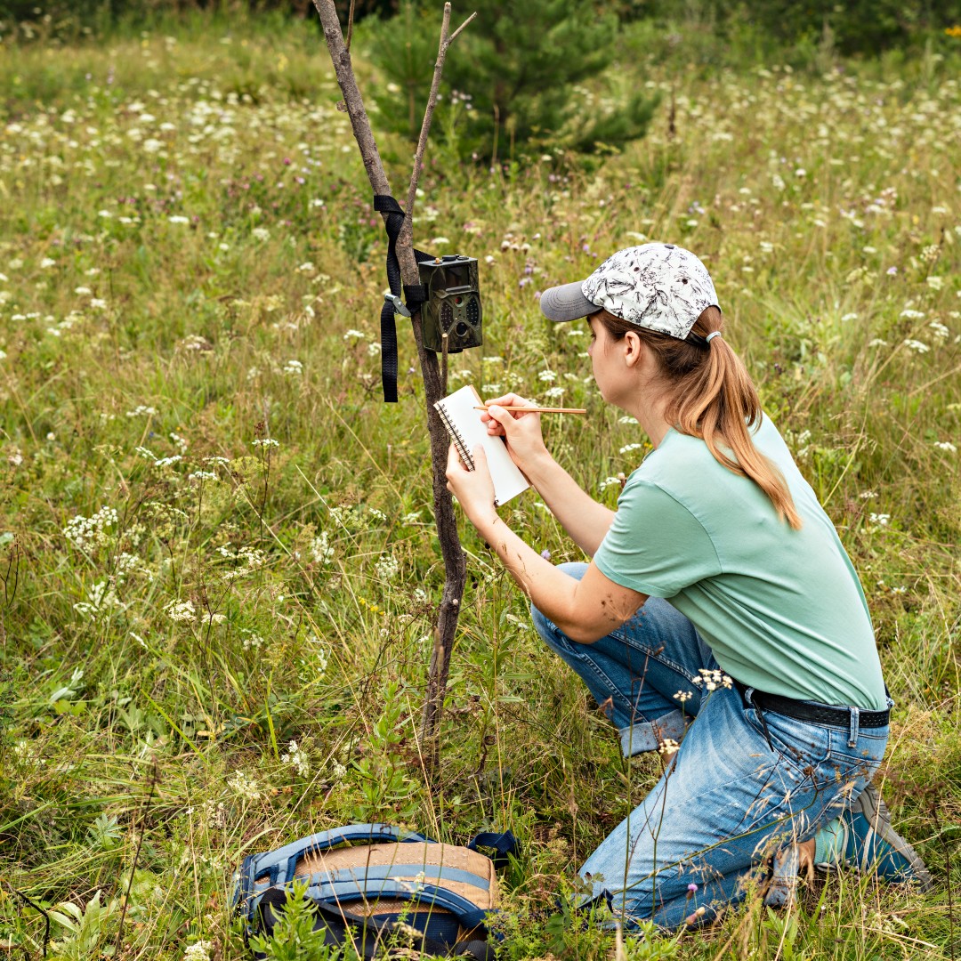
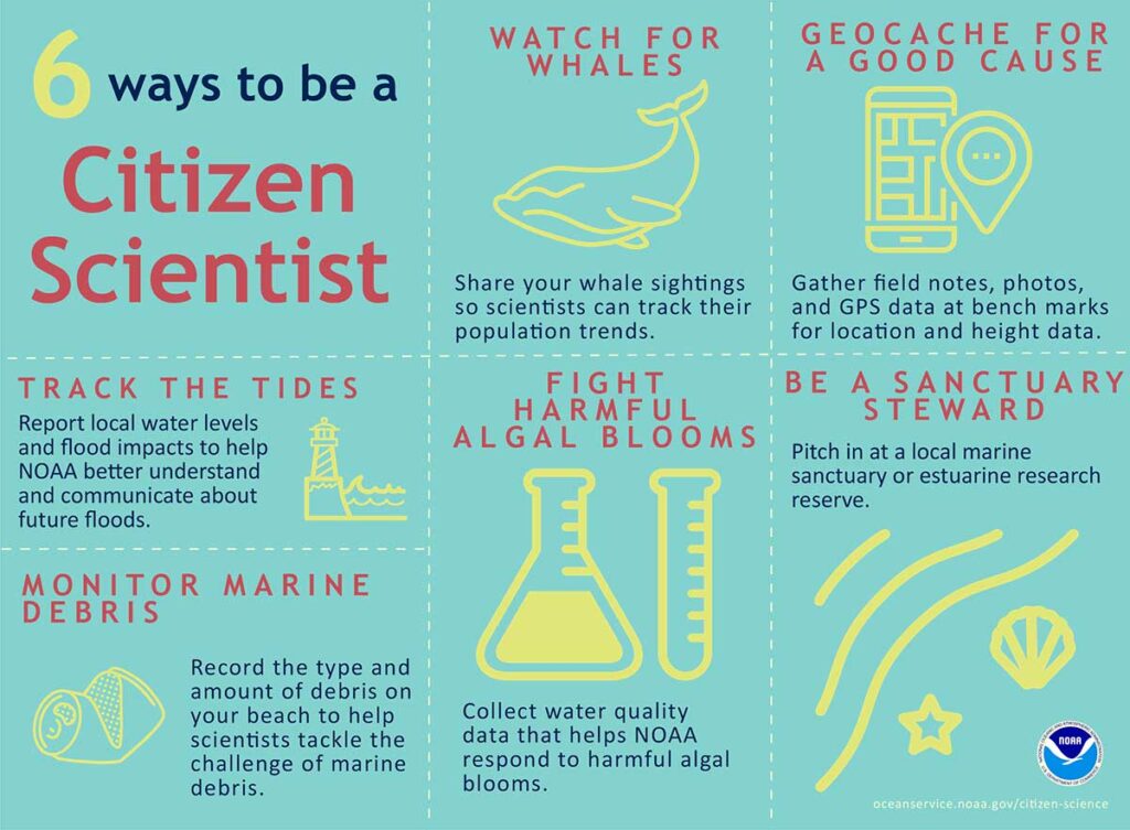
The role of citizen scientists is now well established in some countries in water quality sampling, wildlife monitoring, and monitoring riparian eco-systems.
Citizen scientists could also contribute to flood monitoring by filming sporadic flood events—which was the topic of a previous blog post.
Another promising role for citizen scientists is to measure discharge in small to medium-sized rivers and (irrigation) channels using a smartphone camera. The Global iMoMo Initiative has prepared an Android-based App for this purpose (discharge.ch). Measurements are automatically synchronized with the web where they can be managed, analyzed, and exported or shared.
A Citizen Science Program
A Citizen Science program of a water agency could endeavor to:
- Encourage school, farms, lodges, and other parties to collect environmental data, and share these data by making them available online using infrastructure such as Weather Underground or iMoMo
- Encourage data collectors to share information on monitoring practices, which may provide an indication on the quality of the data to potential data users
- Investigate how to improve monitoring practices and the quality of the data
- Create adequate spatial coverage to improve the value of the (low-cost) data and make it possible to develop useful applications
- Investigate how to make use of these data without compromising the quality standards of the Water Agency.
Closing Comments
This blog focuses on how to manage water resources if you do not have enough data, models, staff, equipment, and budget. Which is, after all, the reality in many countries.
Citizen scientists in combination with developments in environmental sensors, mobile communication, and web-based data management and sharing can contribute to addressing one of these factors: the paucity of water data. Hence there is value to look at these so called ‘low-cost’ data with a new sense of purpose.
Small Data for Big Decisions
Can empowered citizens—including school children and rural youth—who collect hourly data everywhere, generate environmental data and information that enhances nature-based livelihoods while reducing climate related disasters?
My old friend Simon Thuo shared the following insights.
Context
It is not the high accuracy. Rather, it is the ability of millions of citizens using their mobile phones to use remote sensing information, correlated with on-site & real-time weather information, to make critical and informed decisions on floods, how to manage droughts, when to plant, harvest, thresh, or winnow their crops.
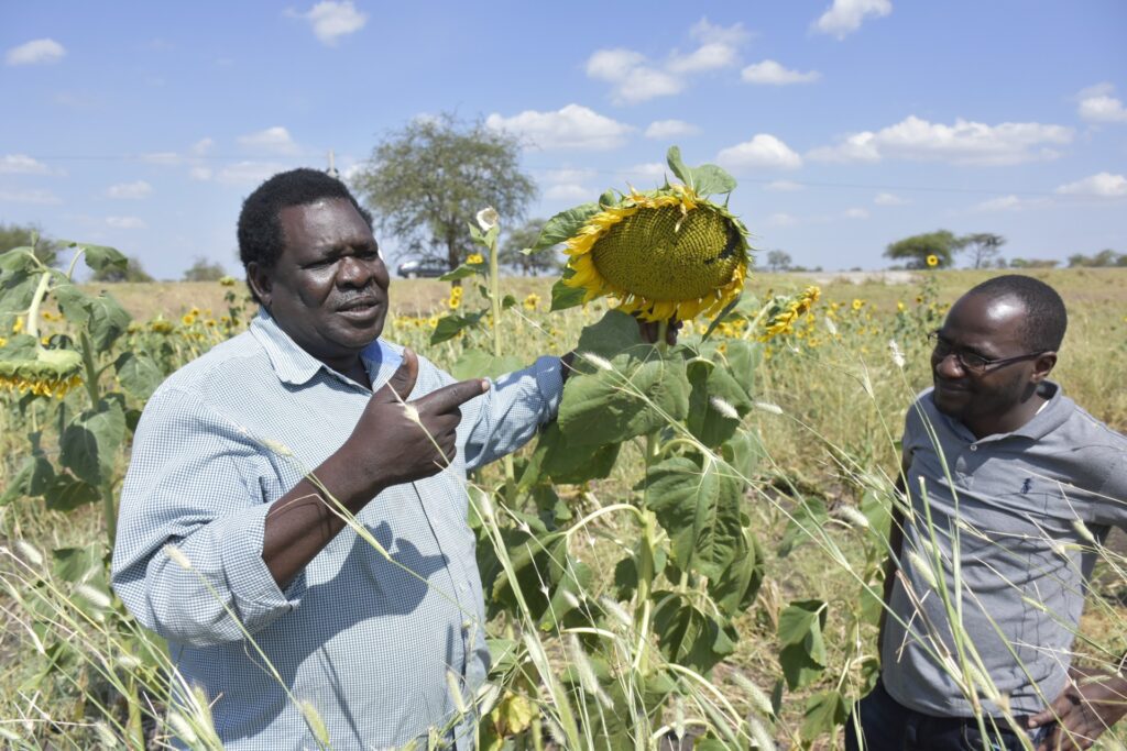
In some parts of the world, post-harvest losses amount to between 40-60% of harvested crop, principally due to moisture in grain and other crops. Real-time weather information can assist farmers to increase the value of their produce by reducing moisture content. The latter is a key determinant of the market price.
Pastoralist can also gain crucial information about the availability of pasture and water, potentially warding off unnecessary conflicts with neighboring farmers, while reducing high levels of livestock deaths due to impacts of drought which they currently essentially must fly blind.
An Example from Karamoja
Jimmy Lomakol is an agro-pastoralist in Napak District in Karamoja, which is Uganda’s most arid and fragile region. When he wakes up in the morning, and several times during the day, he logs onto www.weathercrave.com with the nearest Ugandan meteorological station of Napak as the base. This web-based weather forecast service is freely available.
He uses this service to plan for the coming season. Rain forecasts—including the period and number of days—assist in determining the most valuable crop to plant. It also assists in selecting the crop that will do best given the expected rainfall regime.
He then uses the daily forecast to determine the time to plant based on the expected time of rainfall. Jimmy follows up with monthly forecasts to plan the additional labor he needs—for land preparation, planting, weeding, harvesting, and threshing.
At harvest time, the estimated wind speed (also available on the application) indicates the best time for winnowing, which improve the quality of grain stored without recourse to more expensive equipment.
Due to his adroit use of weather information to determine the cropping calendar, Jimmy obtains twice the yield of his neighbors—and even more when the rainfall season deviates from local expectations.